


North India in Winter’s Deepening Clutch
As December advances, North India finds itself firmly locked in winter’s tightening embrace. Snow-laden winds sweep through the Himalayas, while thick fog blankets the Indo-Gangetic plains, slowing life to a crawl. The season’s severity sharpened around December 21, 2025, when temperatures dipped below freezing in several hill stations and visibility across major cities dropped to alarming levels, underscoring how interconnected mountain and plain weather systems can be.
Setting the Context: A Season Turning Severe
Winter in North India is rarely uniform, but this year’s pattern has been particularly striking. A strong western disturbance—an extratropical weather system moving in from the Mediterranean region—has altered temperature and precipitation trends across the region. The result is a sharp contrast: intense snowfall and biting cold in the hills, alongside dense fog and cold wave conditions in the plains. Together, these phenomena have disrupted transport networks, strained health systems, and raised concerns for agriculture.
Temperature Trends and Regional Extremes
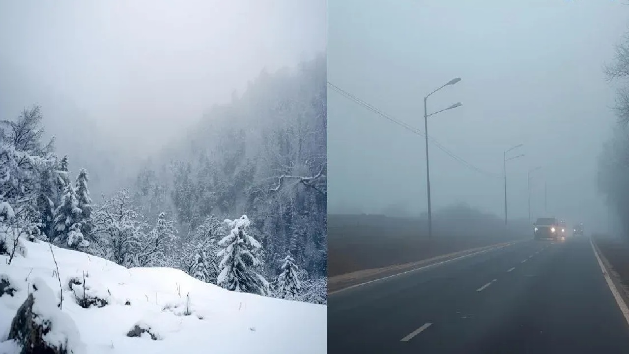
The coldest readings emerged from the higher reaches of Jammu and Kashmir. Sonmarg recorded a minimum of –1.5°C following fresh snowfall, while Gulmarg dropped to –4°C with nearly two inches of snow accumulation in a single day. Srinagar hovered around –2.5°C, marginally below its seasonal norm. These figures reflect a drop of two to four degrees below average across many Himalayan locations.
In contrast, the plains experienced relatively moderate temperatures but amplified discomfort due to persistent fog. Delhi-NCR shivered between 5°C and 9°C, with visibility plunging to as low as 50 metres at times. Rajasthan stood out among the plains: Sikar slipped to 5.8°C—well below normal—while Ganganagar touched 4°C. Punjab, Haryana, and western Uttar Pradesh remained in the 6–9°C range, prompting red alerts in cities such as Agra and Lucknow.
Causes: Why This Cold Spell Feels Harsher
At the heart of this episode lies the western disturbance interacting with Himalayan topography. As moist air masses rise over the mountains, they cool rapidly, producing heavy snowfall. This snow cover enhances surface cooling and allows cold air to pool and drift southward. Clear night skies and reduced rainfall—nearly 20% below average this December—have further intensified radiational cooling, leading to dense fog formation over the plains. Comparisons with previous winters suggest that December 2025 rivals the severity of 2023’s Chillai-Kalan phase and is notably colder than the relatively mild winter of 2024.
Impacts on Daily Life and the Economy
The human and economic costs are already evident. More than 300 flights have been delayed, around 50 trains are running behind schedule, and key highways—such as the Amritsar–Delhi corridor—have witnessed long traffic snarls. In Himachal Pradesh’s Kinnaur region, snowstorms have isolated villages, while prolonged cold threatens rabi crops across northern states. Urban centres are also grappling with rising cases of cold-related illnesses, particularly among vulnerable populations.
What the Forecast Suggests
The India Meteorological Department expects snow and rain to persist in the western Himalayas for another day or two, with fog continuing across Rajasthan and adjoining plains. Some relief is anticipated after December 23 as the disturbance weakens. However, emerging La Niña conditions could extend winter’s intensity well into the coming weeks.
A Reminder of Climatic Interconnections
This cold spell is more than a seasonal inconvenience—it is a reminder of how Himalayan weather cascades into the heart of the subcontinent. The stark divide between hill and plain temperatures highlights growing climate variability and the need for preparedness. As North India navigates the remainder of winter, coordinated responses in transport, agriculture, and public health will be critical to weathering what could be a prolonged and testing season.
(With agency inputs)