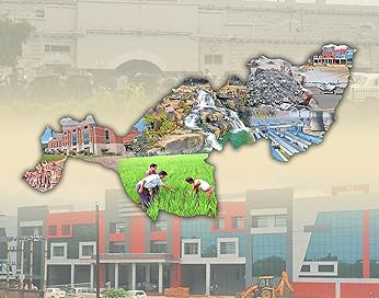
Boudh District, also known as Baudha District, is an administrative division in Odisha, India. It covers a geographical area of 3444.8 sq km, situated between 20°22′ to 20°50′ N Latitude and 83°34′ to 84°49′ E Longitude.
Geography and Demographics:Boudh is bordered by River Mahanadi & Angul District to the north, Kandhamal District to the south, Nayagarh District to the east, and River Tel &Subarnapur District to the west. With a population of 441,162 (2011 Census), the district ranks 22nd in size and 29th in population among Odisha’s thirty districts.
Administration:The district comprises one subdivision (Boudh), 3 tahasils, 3 blocks, 1186 villages, and 69 Gram Panchayats.
Climate and Topography:Boudh experiences a varied climate with four distinct seasons. The district is characterized by plains in the north and highlands in the south. The fertile plains parallel the Mahanadi, and the southern region has hills drained by tributaries of the Tel.
Rivers and Water Bodies:Major rivers like Mahanadi, Bagh, and Salki have played a significant role in shaping the region’s pre-historic culture. The district has tanks and ponds serving purposes like pisciculture, bathing, and irrigation.
Industry and Economy:Boudh’s economy is evolving with small-scale industries in food, metallurgy, textiles, forestry, engineering, and chemicals. Mining contributes substantial revenues. Agriculture, with over 85,000 hectares of cultivable land, focuses on crops like paddy, wheat, maize, ragi, mung, biri, kulthi, groundnut, and mustard.
Cultural and Festive Heritage:The district celebrates various festivals, including Chuda Khai Jatra, Ratha Yatra, Laxmi Puja, Nuakhai, Shivaratri, Dasahara, Dola Jatra, Puajiuntia and Bhaijiuntia, Ramaleela, Kailashi Jatra, Christmas, and Id–Ul–Fitre, showcasing its cultural diversity and traditions.
Public Representatives
List of Member of Legislative Assembly of the District
| SL No. | Constituency Name | Name of MLA | Photo |
| 1 | 85-Kantamal | Mahidhara Rana |  |
| 2 | 86-Boudh | Pradip Kumar Amat |  |


